Required permission:
- View tracking
- View alert (for the Alert tab)
- Resolve alert (to resolve an alert)
- View Chat on Web (for the chat button and the Chat tab)
The user list
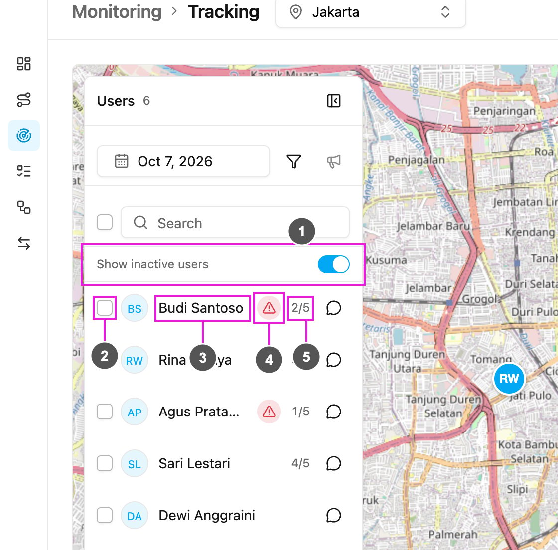
- Show inactive users: list the field workers who have no task on that day too. Turn it off to list only the active ones. It is on when you open the page.
- Checkbox: tick field workers to send them one message with Broadcast. See Broadcast.
- Name: click to select the field worker. Click again to go back to everyone.
- Alert sign: the field worker has an unresolved alert on that day, in the hub selected in the top bar or with no hub.
- Done / total: done tasks out of all the field worker’s tasks on that day, for example 2/5. It is hidden when they have no task.
A selected field worker
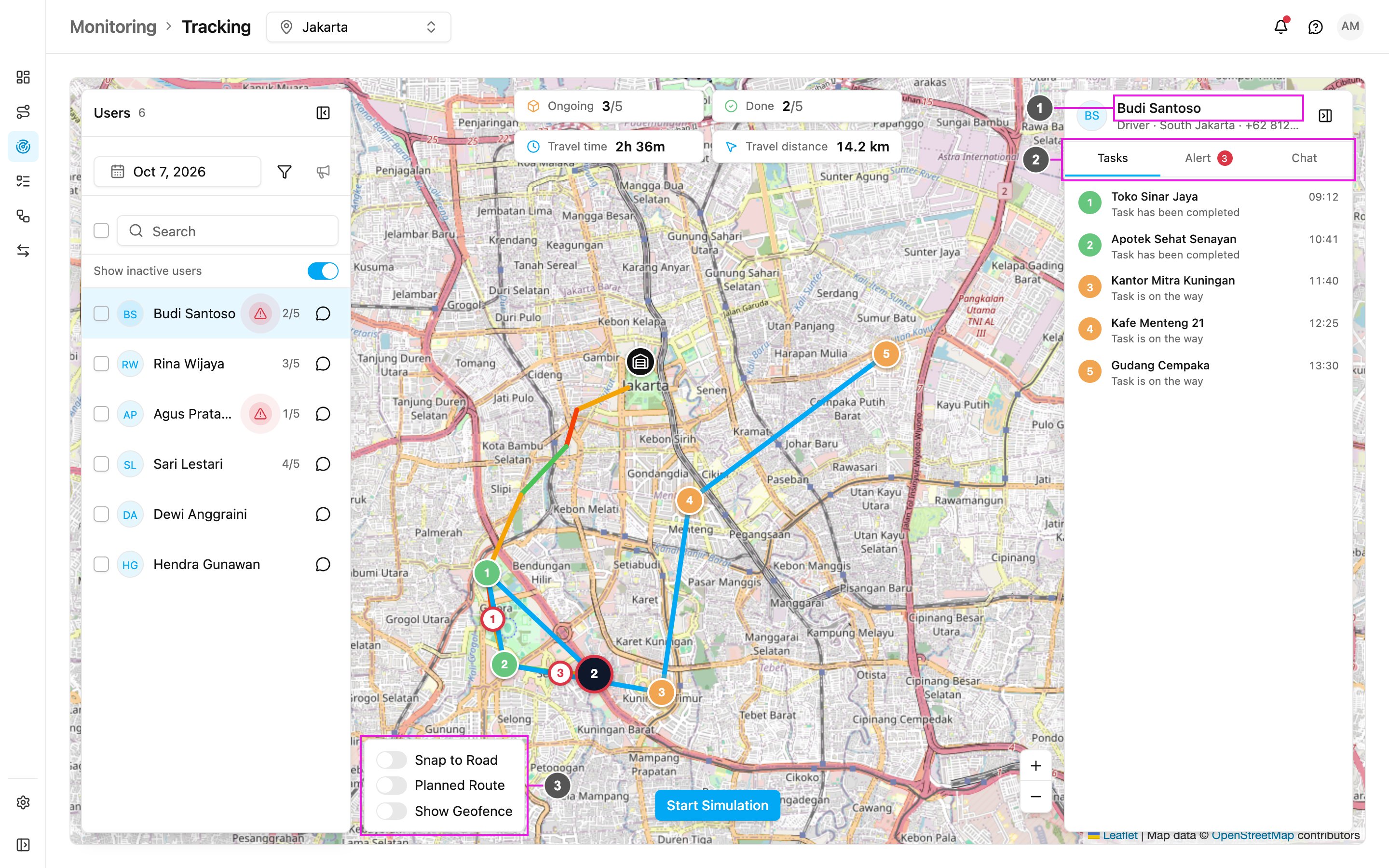
- Name: the field worker the panel is about. Below it are their role, their teams in this hub and their phone number. The button on the right hides the panel. Show it again with the same button.
- Tasks / Alert / Chat: the panel’s tabs. The number on Alert is how many unresolved alerts the field worker has on that day, for example 3. It is hidden when there are none, and shows 99+ above 99.
- Snap to Road / Planned Route / Show Geofence: change how the route is drawn, and draw your geofences on the map. See Map Icons and Routes.
- their latest location (the user icon),
- the actual route they travelled, coloured by speed,
- a blue line to their remaining tasks,
- a numbered icon for each task, and a numbered ring for each alert.
Tasks
The Tasks tab lists the field worker’s tasks of that day in planned order. Each row shows:- Number: the task’s place in the list, coloured by status (green done, orange ongoing, grey not assigned).
- Title: the task title, or the flow’s name if the task has no title.
- Progress: Task has been completed, Task is near the destination or Task is on the way.
- Time: when the task was done, or its planned arrival time if it is not done yet.
Alert
The Alert tab lists the alerts raised for this field worker on that day: geofence, idle, route deviation, lateness, overspeed and panic button alerts. When you open it, it lists only the unresolved ones. Like the Alert page, the tab shows only the alerts of the hub selected in the top bar, plus the alerts that have no hub. A field worker who belongs to several hubs may have alerts that are listed only when their other hub is selected.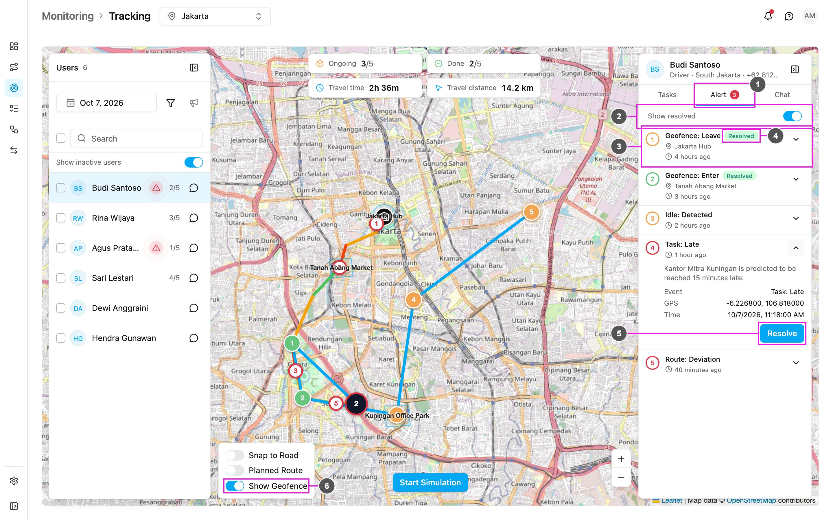
- Alert: the number is how many unresolved alerts there are.
- Show resolved: also list the alerts that were already resolved. It is off when you open the tab.
- Alert row: the alert type (for example Geofence: Leave), the place and how long ago it happened. Click a row to highlight its ring on the map. The arrow opens the row to show the message and the details: event, location, GPS, time, and, once resolved, who resolved it and their notes.
- Resolved: marks an alert that was already resolved. It only appears when Show resolved is on.
- Resolve: record that the alert was handled. Only unresolved alerts have this button.
- Show Geofence: draw your geofences on the map, so you can see the area an alert is about. The switch is with the other map switches at the bottom left of the map, and appears when the hub has geofences.